SANTACHI uses cookies and similar technologies on the website. The essential cookies are necessary to operate the website. You can accept or reject non-essential cookies by clicking the "Accept" or "Reject" button. You can change your settings at any time. For details about the cookies, please review our Cookies Policy.
News & Events
The Alert Is Up. But How Close Is the Threat?
July 9, 2026
131
Santachi H8 Lets Distance Data Speak for Grid O&M
A Province of Hills, Coastlines, and Growing Alerts
Zhejiang sits along China’s southeastern coast, where mountains, hills, coastal weather, and fast-moving industrial development meet. Transmission corridors here often pass through forests, construction zones, industrial parks, and typhoon-prone coastal areas.
For grid operators, that creates a daily challenge.
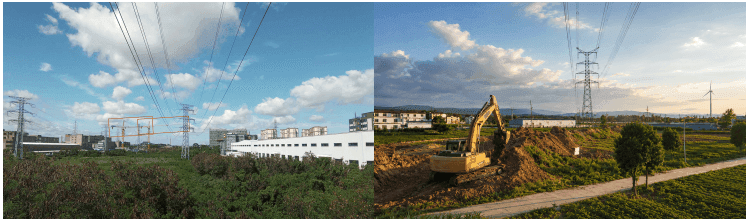
Cranes and excavators may appear near overhead lines during nearby construction.
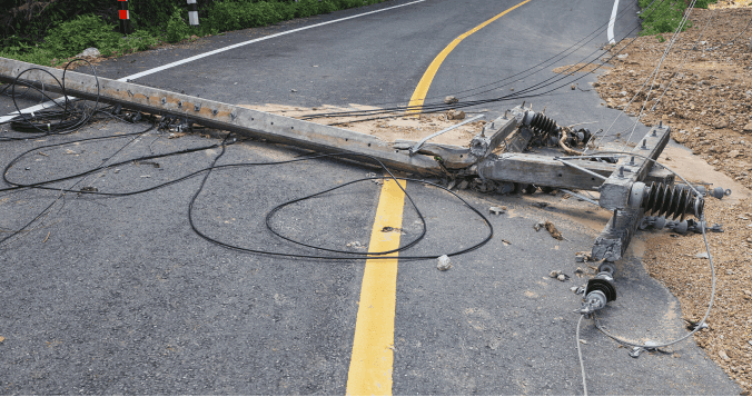
Trees keep growing toward conductors. After typhoons, vegetation can shift, tilt, or fall into risky positions.
These hazards are not rare events. They are part of the operating environment.
For years, local power supply teams relied on visual monitoring devices to inspect transmission corridors remotely.
These systems could detect potential external-damage targets, but they could not answer the question that matters most:
How close is it to the conductor?
A crane may appear near the line. But is it 20 meters away, 8 meters away, or already approaching the safety clearance zone?
Without reliable distance data, operators had to make judgment calls based on images alone. As more unquantified alerts flowed into the platform, truly urgent risks were mixed with low-value notifications.
The result was familiar: more alerts, more manual checking, and more pressure on O&M teams.
Seeing a Crane Isn’t the Same as Knowing the Risk
Near Does Not Always Mean Dangerous
Traditional image-based monitoring devices can detect cranes, excavators, and other construction machinery near transmission corridors. But detection alone does not tell operators whether the target is actually threatening the line.
That is where the problem begins.
Some targets look close in the image but remain safely outside the clearance zone. Others may be approaching a critical distance and require immediate response. Without measurement, both can look similar on screen.
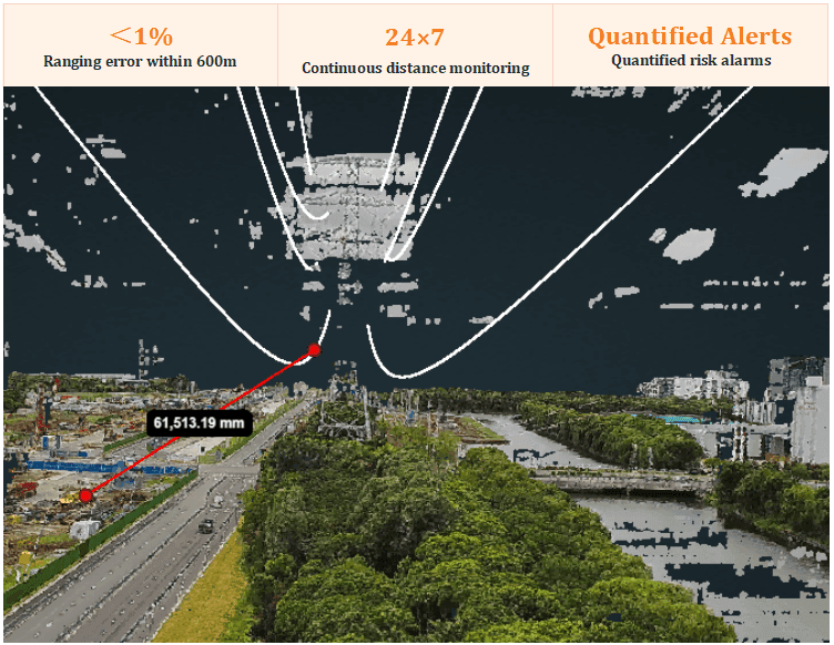
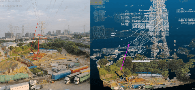
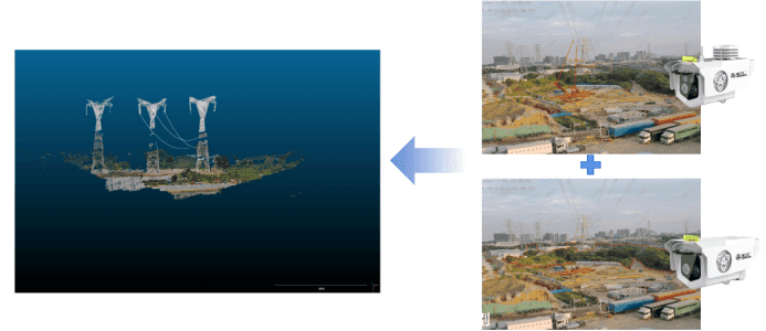
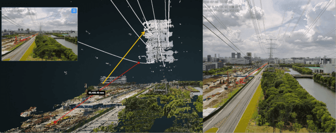
Santachi’s approach: H8 integrates binocular multi-focal stereo vision with an 8-megapixel ranging lens to enable 24/7 low-power guarding for transmission corridor risks. When identifying external-damage targets such as cranes and excavators, the system automatically activates the ranging lens to perform 3D point-cloud modeling and calculates the straight-line distance between the hazard target and the conductor in real time.
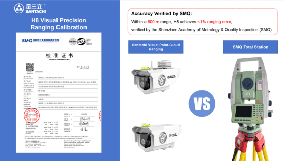
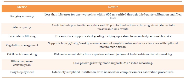
Within a 600-meter range, the distance measurement error is less than 1% for any two points.
This changes how alerts work. H8 does not simply report that a target has appeared. It reports the target with measured distance as evidence.
Distance data is overlaid directly on the video image and alert information, allowing operators to understand the risk at a glance. A crane that is simply nearby can be separated from a crane that is truly approaching the danger zone.
The decision moves from:
“It looks close.” “The measured distance confirms the risk.”
Vegetation Risk Evolves Between Inspections
Vegetation encroachment has always been one of the hardest risks to manage along transmission corridors.
UAV-based LiDAR inspections can provide accurate point-cloud data, but they are usually periodic and costly. They are excellent for scheduled inspections, but not ideal for frequent clearance tracking.
Laser distance meters and millimeter-wave radar can help in certain scenarios, but their coverage range and adaptability are limited. They cannot easily support flexible vegetation distance measurement across complex outdoor environments.
The result is simple: vegetation clearance may be checked on a schedule, but trees keep growing, shifting, and changing between measurements.
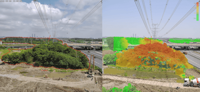
Santachi’s approach: With binocular stereo vision, AI optimization, large-model segmentation frameworks, and high-quality training datasets, the system can extract tree regions from complicated backgrounds, perform semantic segmentation, and calculate clearance distance. When the clearance distance approaches the threshold, the system triggers graded alerts and helps O&M teams precisely locate the highest-risk points within vegetation areas.
For vegetation risks, H8 supports configurable scheduled measurement tasks—such as daily or weekly checks—from fixed monitoring points, enabling regular tracking of vegetation-to-conductor clearance. Operators can also trigger distance measurement manually at any time for quick verification when potential risks are observed.
Vegetation management is no longer limited to the next inspection cycle.
It becomes a more frequent, stable scheduled measurement of clearance risk, with on-demand verification.
Instead of waiting for the next UAV flight, operators can see how close the trees are today.
Standards Draw the Line. Operators Still Need the Measurement.
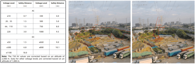
Safety clearance requirements vary by voltage level. Operators know the standards, but traditional monitoring systems often cannot connect those standards to what is happening in the field.
Without real-time distance measurement, alert thresholds may depend heavily on experience. That makes risk assessment harder to standardize, harder to quantify, and harder to trace.
Santachi’s approach: H8 links measured distance data with safety clearance thresholds defined in relevant technical standards GB 26859-2011. Alert levels can be matched with voltage level, measured distance, and configurable platform rules.
This allows the platform to classify risks based on evidence rather than visual estimation.
Operators no longer need to ask, “Does it look too close?”
They can ask, “What does the measured distance say?”
The standard defines the safety boundary. H8 provides the measurement.
When Distance Data Starts Speaking for the Alert
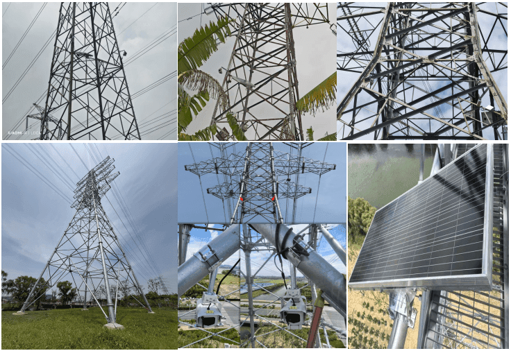
In this project, H8 real-time high-precision 3D point-cloud distance measurement cameras were deployed across key sections of local transmission corridors, covering external-damage-prone areas and vegetation-dense segments.
After deployment, the system supported three core capabilities:
External-damage distance alerts
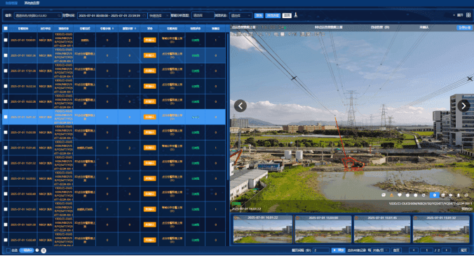
With 24/7 low-power guarding, H8 keeps watch over corridor risks while reducing field power consumption. When construction machinery enters a monitored corridor, H8 automatically completes the full process of target detection, image segmentation, distance measurement, and alert generation. Each alert includes precise distance data and 3D point-cloud evidence, enabling operators to quickly determine whether emergency response is required.
Agile vegetation clearance monitoring
The system performs scheduled vegetation-to-conductor clearance measurement at fixed points (e.g., daily or weekly), enabling consistent tracking of clearance changes. Operators can also manually trigger measurements when needed.
Invalid alert filtering
Distance data becomes the quantitative basis for alert grading. Targets that appear close but remain within safe limits no longer need to be treated as high-priority risks. Platform alerts become more actionable, helping operators focus on events that truly require attention.
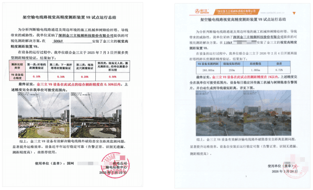
Accuracy verification: H8’s distance measurement accuracy has been calibrated and certified by the Shenzhen Academy of Metrology & Quality Inspection (SMQ). Field validation tests show a span measurement error of 0.87% and a comprehensive tower-structure measurement error of 0.62%. Comparison tests against third-party instruments—including total stations, laser distance meters, and TruPulse devices—also demonstrate errors consistently below 1%.
These results demonstrate that H8 meets the accuracy requirements for transmission line distance measurement in real-world field applications.
Results in Numbers
Every Alert, Backed by a Measured Distance
An alert should not simply say that something has appeared near the line. It should help operators understand whether the line is actually at risk.
With Santachi H8, external-damage monitoring moves beyond target detection and into distance-based risk assessment. Vegetation risks no longer wait for the next UAV flight; the clearance can be measured online whenever needed. O&M decisions move beyond visual estimation and into measurable evidence.
For local power supply teams in Zhejiang, H8 is helping build a more accurate, efficient, and quantifiable transmission O&M workflow.
Every alert now comes with something operators can trust:
a measured distance.
H8 Nationwide Track Record
H8 pilot deployments have covered 23 provinces and 42 cities across China, with customer-side accuracy verification completed in 23 cities. The product line has achieved a leading market presence in high-precision 3D point-cloud distance measurement applications for transmission line monitoring.